

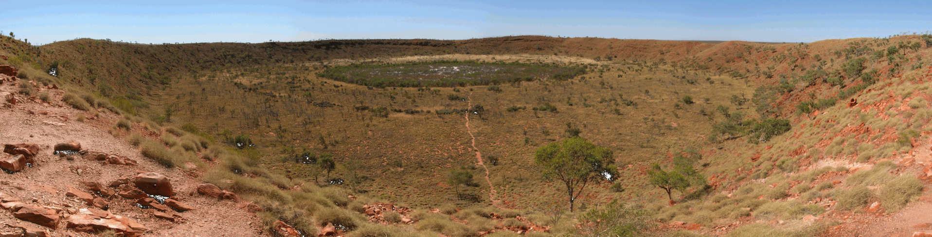
Wolfe Creek Crater, Tanami, WA
"In far too many projects, this level of detail in regolith mapping is missing or in some cases largely absent, precluding coherent interpretation of data."
Roland Gotthard
Profile
Richard has 37 years experience in national and state geological surveys in Australia, Europe, the Pacific and Asia, and in the mineral exploration industry in WA, NT, Queensland and Tasmania.
In 1977, he joined the Institute of Geological Sciences (now BGS: British Geological Survey), working in minerals intelligence and regional mapping (UK, Solomon Islands and Hong Kong).
In 1994, Richard moved from the Hong Kong Geological Survey to the Geological Survey of Western Australia (GSWA), and in 1995 assisted with the development of Pakistan’s National Mineral Policy. In the GSWA, he was the Project Manager for "Mineral Prospectivity Mapping", the “Inventory of Abandoned Mine Sites” and “Development Areas Resources Mapping”.
In 2003, he contributed to the Commonwealth Mineral Exploration Action Agenda as Secretariat to the Access to Land Working Group, and in 2004, as General Manager for Strategic Development in the Safety, Health and Environment Division, was responsible for the policy framework for managing abandoned mine sites.
Before leaving GSWA, he managed the NGSA sampling program in WA, completed regolith-landform mapping in the Tanami, biodiversity site geology in the Pilbara, and developed innovative techniques for the use of Landsat and SRTM data in support on mineral exploration.
In 2008, Richard first worked for Maximus Resources on the Windimurra magnetite deposit, then Flinders Mines on their Hamersley CID and BID prospects, TNT Mines on tin/tungsten deposits in northeast Tasmania, and Abra Mining's base metal prospects in the Bangemall Basin.
Consulting work since 2008 has included BIF mapping in WA, oolitic ironstone mapping in the NT, base metal core logging in Queensland, and remote sensing for iron in West Africa and manganese in East Timor.
Qualifications
- BSc PhD FGS CGeol
- BSc Honours, Geology – University of Durham, UK, 1973
- PhD – Council for National Academic Awards, UK, 1980 “Deformation in the Moine south-east of Glencarron, Highland Region, Scotland”
- Fellow of the Geological Society (JORC Recognised Overseas Professional Organisation)
- Chartered Geologist
Publications
LANGFORD, R L (2015). Temporal merging of remote sensing data to enhance spectral regolith, lithological and alteration patterns for regional mineral exploration. Ore Geology Reviews, 68, 14-29. http://dx.doi.org/10.1016/j.oregeorev.2015.01.005
LANGFORD, R L (2007). Regolith-terrain mapping in the Tanami. Western Australia Geological Survey Record 2007/2, p 2-3.
GOZZARD, J R and LANGFORD, R L (2005). Remote sensing and high-resolution landscape models in predictive geological mapping. WALIS Forum 2005, Perth, WA, 10 p
CUDAHY, T, LANGFORD , R , HAUSKNECHT, P, and HEWSON, R (2004). New generation maps of regolith mineralogy and regolith stratigraphy from new generation remote sensing data, in Dynamic Earth: past, present and future edited by J McPHIE and P McGOLDRICK. 17th Australian Geological Convention, Hobart, Tasmania, February 2004: Geological Society of Australia, Abstracts 73, p 11
KELLY S M, LANGFORD R L and BIGGS W (2004). Aligning Western Australia’s sustainability strategy with safety, health and environmental outcomes in the mining industry. Minerals Council of Australia, 2004 Inaugural Global Sustainable Development Conference, 7 p
GOZZARD, J R and LANGFORD, R L (2004). Remote sensing and high-resolution landscape models in predictive geological mapping. Remote Sensing and Photogrammetry Commission of the Spatial Sciences Institute, 12 th >Australasian Remote Sensing and Photogrammetry Conference, Fremantle, WA
LANGFORD, R L, HARVEY, S L, and RUDDOCK, A E (2003). Access to land for mineral exploration – Background paper. Mineral Exploration Action Agenda, Access to Land Working Group Secretariat, Perth , 56 p
LANGFORD R L (2001). Regolith–landform resources of the Howatharra 1:50 000 sheet. Western Australia Geological Survey Record 2001/7, 61 p
LANGFORD R L, WYCHE S and LIU S F (2000). Geology of the Wiluna 1:100 000 sheet. Western Australia Geological Survey, 1:100 000 Geological SeriesExplanatory Notes 26 p
LANGFORD R L (2000). Regolith–landform resources of the Geraldton 1:50 000 sheet. Western Australia Geological Survey Record 2000/17, 37 p
MARNHAM J, HALL G and LANGFORD R L (2000). Regolith–landform resources of the Cowaramup–Mentelle 1:50 000 sheet. Western Australia Geological Survey Record 2000/18, 55 p
LANGFORD R L and FARRELL T R (1998). Geology of the Duketon 1:100 000 sheet. Western Australia Geological Survey, 1:100 000 Geological SeriesExplanatory Notes 27 p
COOPER R W, LANGFORD R L and PIRAJNO F (1998). Mineral occurrences and exploration potential of the Bangemall Basin. Western Australia Geological Survey Report 64, 42 p
LANGFORD R L (1997). Satellite image maps for geological mapping and exploration. WALIS Forum ’97 Proceedings p 111–113
LANGFORD R L (1995). Metamorphosed Archaean spherulitic felsic lavas on Mason Hill, Duketon, Eastern Goldfields. Western Australia Geological Survey Annual Review 1994–95 p 98–101
LANGFORD R L, JAMES J W C, SHAW R, CAMPBELL S D G, KIRK P A and SEWELL R J (1995). Geology of Lantau District, 1: 20 000 Sheets 9, 10, 13 and 14. Hong Kong Geological Survey Memoir No 6. Geotechnical Control Office, Hong Kong, 173 p
LIU S F, HICKMAN A H and LANGFORD R L (1995). Stratigraphic correlations in the Wiluna greenstone belt. Western Australia Geological Survey Annual Review 1994–95 p 81–88
BUSBY J P and LANGFORD R L (1995). Interpretation of the regional gravity survey of Hong Kong. Hong Kong Geologist Vol 1 p 52–66
LAI K W and LANGFORD R L (1995). Spatial and temporal characteristics of major faults of Hong Kong. Hong Kong Geological Society Bulletin No 5 p 72–84
LANGFORD R L (1994). Geology of Chek Lap Kok, 1:5 000 Sheet 9-NE-C/D. Hong Kong Geological Survey Sheet Report No 2, 61 p.Geotechnical Engineering Office, Hong Kong
SEWELL R J, LANGFORD R L and STRANGE P J (1993). Stratigraphy and geochemistry of Upper Jurassic to Lower Cretaceous volcanic rocks of Hong Kong. Abstracts of the International Association of Volcanology and Chemistry of the Earth’s Interior, General Assembly, Canberra, Australia, p 98
LANGFORD R L (1992). Geological Society of Hong Kong Bulletins and other publications index and bibliography. Geological Society of Hong Kong Newsletter Vol 10 No 1 p 6–15
LANGFORD R L (1992). New logo for the Geological Society of Hong Kong. Geological Society of Hong Kong Newsletter Vol 10 No 2 p 10
LANGFORD R L (1992). Hong Kong's new airport – the role of geological survey. In: FOWLER P and EARLE Q (Editors). Asia Pacific – quarrying the rim. Proceedings of Institute of Quarrying Conference, p 311–318
BUSBY J P, EVANS R B, LAM M S, RIDLEY THOMAS W N and LANGFORD R L (1992). The gravity base station network and regional gravity survey of Hong Kong. Geological Society of Hong Kong Newsletter Vol 10 No 1 p 2–5
SEWELL R J, DARBYSHIRE D P F, LANGFORD R L and STRANGE P J (1992). Geochemistry and Rb–Sr geochronology of Mesozoic granites from Hong Kong. Transactions of the Royal Society Edinburgh: Earth Sciences Vol 83 p 269–280
LANGFORD R L (1991). Discussion on Marble clasts in coarse ash crystal tuff at Au Tau, New Territories, Hong Kong. Newsletter Vol 9 No 1 p 16–19, 1991. Geological Society of Hong Kong Newsletter Vol 9 No 2 p 52
LANGFORD R L (1991). Geological Society of Hong Kong Newsletter index and bibliography, 1982–1991. Geological Society of Hong Kong Newsletter Vol 9 No 4 p 31–46
LANGFORD R L (1991). Geology of the Tsing Ma Bridge anchor sites. Geotechnical Engineering Office, Geological Report GR 1/91, 30 p
SEWELL R J and LANGFORD R L (1991). Second Hutton symposium on the origin of granites and related rocks. Excursion C2 – Granites of Hong Kong. 30 September – 2 October 1991. Geological Society of Hong Kong Newsletter Vol 9 No 3 p 3–28
SEWELL R J, STRANGE P J, LANGFORD R L and DARBYSHIRE D P F (1991). Petrogenesis, geochemistry, and age of Hong Kong granitoids. Abstracts of the Second Hutton Symposium on Granites and Related Rocks, Canberra, Australia, p 92
WOODS N W and LANGFORD R L (1991). The geology and exploitation of the West Brother Island graphite deposit. Geological Society of Hong Kong Newsletter Vol 9 No 2 p 24–36
LANGFORD R L (1990). Geology of Chek Lap Kok. New Airport at Chek Lap Kok, Geotechnical Investigation (1990), Volume 3. Geotechnical Control Office Advisory Report ADR 13/90, 73 p plus map
LANGFORD R L (1990). Geology of Chek Lap Kok. Geological Society of Hong Kong Newsletter Vol 8 Pt 4 p 21–39
LANGFORD R L (1990). Definition of a karst surface zone using ground investigation data. In: LANGFORD R L, HANSEN A and SHAW R (Editors). Karst geology in Hong Kong. Geological Society of Hong Kong Bulletin No 4 p 99–106
LANGFORD R L (1990). Trial magnetometer survey in Yuen Long Industrial Estate, Hong Kong. In: LANGFORD R L, HANSEN A and SHAW R (Editors). Karst geology in Hong Kong. Geological Society of Hong Kong Bulletin No 4 p 215–225
LANGFORD R L and HADLEY D (1990). New debris flow on the flanks of Tsing Shan, Hong Kong. Geological Society of Hong Kong Newsletter Vol 8 Pt 3 p 2–12
LANGFORD R L and HADLEY D (1990). Photographic feature. New debris flow on the flanks of Tsing Shan, Hong Kong. Geotechnical Engineering Vol 21 No 2 p 105–107
LANGFORD R L, HANSEN A and SHAW R (Editors) (1990). Karst geology in Hong Kong. Geological Society of Hong Kong Abstracts No 6, 58 p
LANGFORD R L, HANSEN A and SHAW R (Editors) (1990). Karst geology in Hong Kong. Geological Society of Hong Kong Bulletin No 4, 243 p
ATHERTON M J and LANGFORD R L (1990). Report on field trip to Tsing Shan, Sunday 1 July 1990. Geological Society of Hong Kong Newsletter Vol 8 Pt 2 p 32
LANGFORD R L, LAI K W, ARTHURTON R S and SHAW R (1989). Geology of the Western New Territories, 1: 20 000 Sheets 2, 5 and 6. Hong Kong Geological Survey Memoir No 3. Geotechnical Control Office, Hong Kong, 135 p
GEOTECHNICAL CONTROL OFFICE (1988). Guide to rock and soil description, Geoguide 3. Geotechnical Control Office, Hong Kong, 189 p
ADDISON R, LANGFORD R L and SHAW R (1988). Resource and reserve definition for offshore materials in Hong Kong. In: WHITESIDE P G D and WRAGGE-MORLEY N (Editors). Marine sand and gravel resources of Hong Kong. Geological Society of Hong Kong, Hong Kong, p 198–202
LANGFORD R L, ARTHURTON R S and LAI K W (1987). Geological survey and ground investigation in Tuen Mun, western New Territories, Hong Kong. In: WHITESIDE P G D (Editor). The Role of Geology in Urban Development. Geological Society of Hong Kong Bulletin No 3 p 199–207
LANGFORD R L (1987). Report on pre-symposium seminars. Geological mapping in the urban environment. In: WHITESIDE P G D (Editor). The Role of Geology in Urban Development. Geological Society of Hong Kong Bulletin No 3 p 589–590
LANGFORD R L (1987). Geological notes on Sha Chau, Hong Kong. Geological Society of Hong Kong Newsletter Vol 5 No 3 p 8–12
LANGFORD R L (1987). Nature and occurrence of Hong Kong rocks and superficial deposits. Geotechnical Control Office Technical Note TN 1/87, 27 p
LANGFORD R L (1987). The geology of Yuen Long Industrial Estate. Geotechnical Control Office Advisory Report ADR 40/87, 14 p plus 3 maps
HO L P and LANGFORD R L (1987). Petrographic study of metamorphism in tuffs of the Tai Mo Shan Formation, northwestern New Territories, Hong Kong. Geological Society of Hong Kong Newsletter Vol 5 No 4 p 9–13
DUNKLEY P N et al (1986). The geology of the New Georgia Group, Western Solomon Islands. British Geological Survey Overseas Directorate Report MP/86/6, 83 p
LANGFORD R L (1985). Page 67 in discussion of SHAW R (1985). Preliminary interpretations of the Quaternary Stratigraphy of the eastern part of the Pearl River Estuary. In: WHITESIDE P G D and ARTHURTON R S (Editors). Marine Geology of Hong Kong and the Pearl River Mouth, Geological Society of Hong Kong, Hong Kong
LANGFORD R L and ADLAM K A McL (1985). Vector: a computer program for the analysis and manipulation of three-dimensional orientation data. Engineering Development Department, Hong Kong, 27 p
LANGFORD R L and LYNAS B D T (1985). Geological notes and local details for 1:10 000 sheets: SO 39 NE (Bridges and Stiperstones); part of 1:50 000 sheets 151 (Welshpool), 152 (Shrewsbury), 165 (Montgomery) and 166 (Church Stretton). British Geological Survey, Keyworth, 18 p
LYNAS B D T and LANGFORD R L (1985). Geological notes and local details for 1:10 000 sheets: SO 39 NW (Shelve and Corndon); part of 1:50 000 sheets 151 (Welshpool) and 165 (Montgomery). British Geological Survey, Keyworth, 57 p plus erratum
HAINS B A and LANGFORD R L (1985). Geological notes and local details for 1:10 000 sheets : SO 39 SE (Norbury); part of 1:50 000 sheets 165 (Montgomery) and 166 (Church Stretton). British Geological Survey, Keyworth, 11 p
CAVE R, LYNAS B D T and LANGFORD R L (1985). Geological notes and local details for 1:10 000 sheets SO 39 SW (Hyssington and Lydham); part of 1:50 000 Sheet 165 (Montgomery). British Geological Survey, Keyworth, 42 p
PRICE D, LANGFORD R L and WILSON A A (1984). Geological notes and local details for 1:10 000 Sheets: SK 00 SE (Aldridge); part of 1:50 000 Sheet 154 (Lichfield). British Geological Survey, Keyworth, 19 p
WILSON A A, LOWE D J, PRICE D and LANGFORD R L (1984). Geological reports for DOE: Land-use planning SK 00 SW and SK 00 SE (Aldridge–Brownhills). British Geological Survey, Keyworth
LANGFORD R L (1980). Perlite. Mining Annual Review p 132–133
LANGFORD R L (1980). Magnesium. Mining Annual Review p 67–68
LANGFORD R L (1979). Perlite. Mineral Resources Consultative Committee Mineral Dossier No 21. HMSO, London, 37 p
LANGFORD R L (1979). Perlite. Mining Annual Review p 126
LANGFORD R L (1978). Perlite. Mining Annual Review p 124